Working together for a flood-resilient Newstead
Newstead has a history of flooding. Most recently, the town experienced flood events in 2000, 2010, 2011, 2016 and 2022. Therefore, Council is working with Water Technology to carry out a flood study and develop a flood mitigation strategy for Newstead and provide property saving solutions.
Newstead does have an earthen levee that protects against flooding events similar to the size of the 2022 flood, however the characteristics of the levee are unknown, and no formal management arrangement of the levee exists. Future floods are predicted to be more severe, associated with increased rainfall intensities. This may lead to more frequent floods that could breach the existing levee.
Water Technology have simplified the potential solutions and presented them below as five (5) mitigation options. These are listed below, and we are now seeking community input on the prioritisation of these options at the bottom of this page.
Provide your feedback on the flood mitigation options by August 8
As part of the Newstead Flood Study Council and stakeholders have developed three mitigation options as outlined below, with the objective of managing future flooding in Newstead. Please read them carefully and provide your feedback at the bottom of the page.
What is 1% Annual Exceedance Probability (AEP)?
Annual Exceedance Probability (measured as a percentage) is a term used to describe the magnitude (size) of a flood. It is a way of describing the probability of a flood of a particular size being equalled or exceeded in any given year. For example, a 1% AEP flood is a flood that has a 1% chance of occurring in any one year.
Mitigation option 1: Vegetation removal
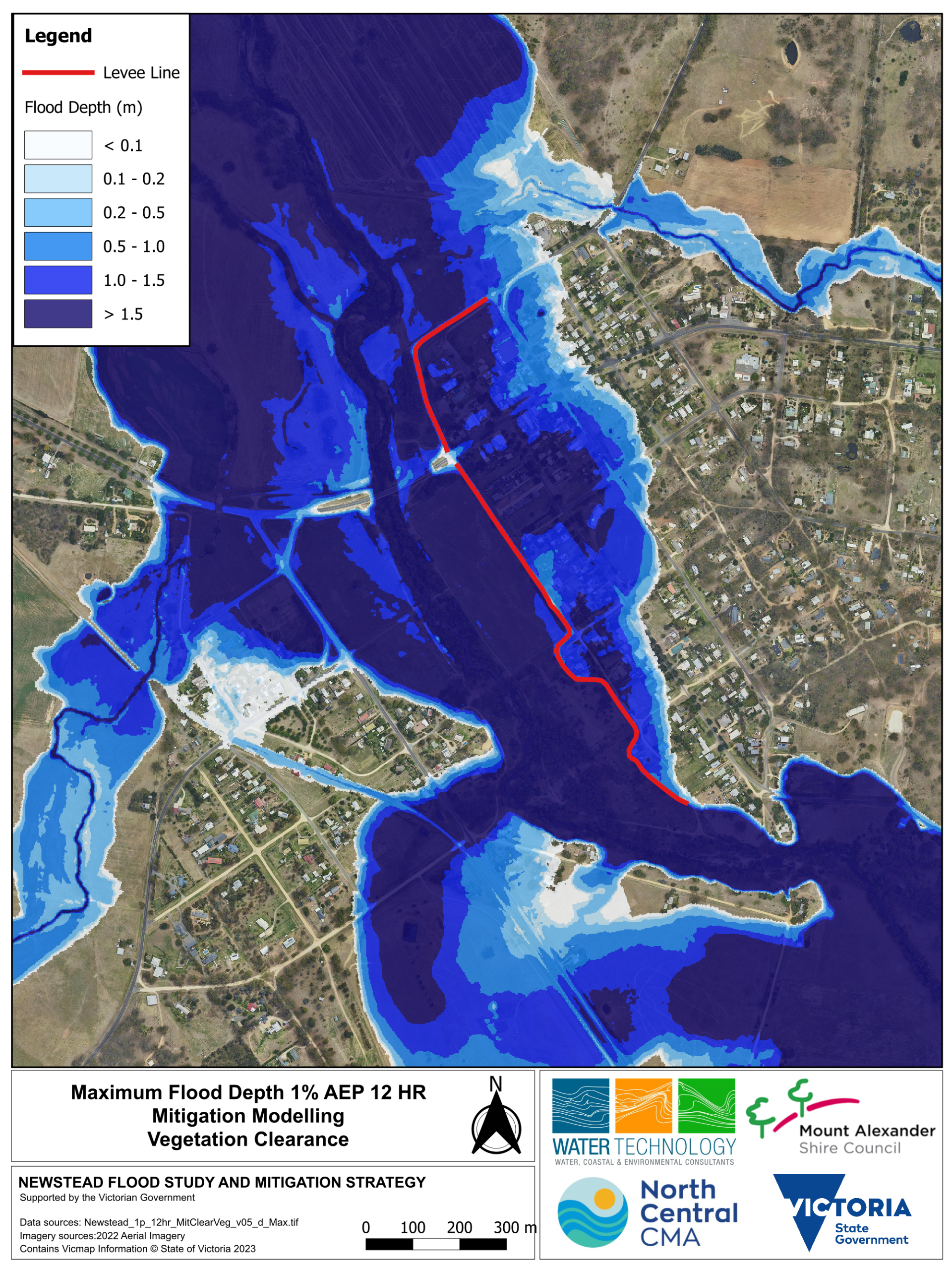
Action: Vegetation clearance within and along the Loddon River near and downstream of the Pyrenees Highway bridge.
Modelling results indicate that in a 1% AEP event:
- East of levee: water levels will drop by up to 15 cm
- West of levee: water levels will drop by up to 30 cm
- East of the levee: 2 fewer properties would experience water above the floor level
- West of the levee: 1 less property would experience water above the floor level
Click maps to enlarge
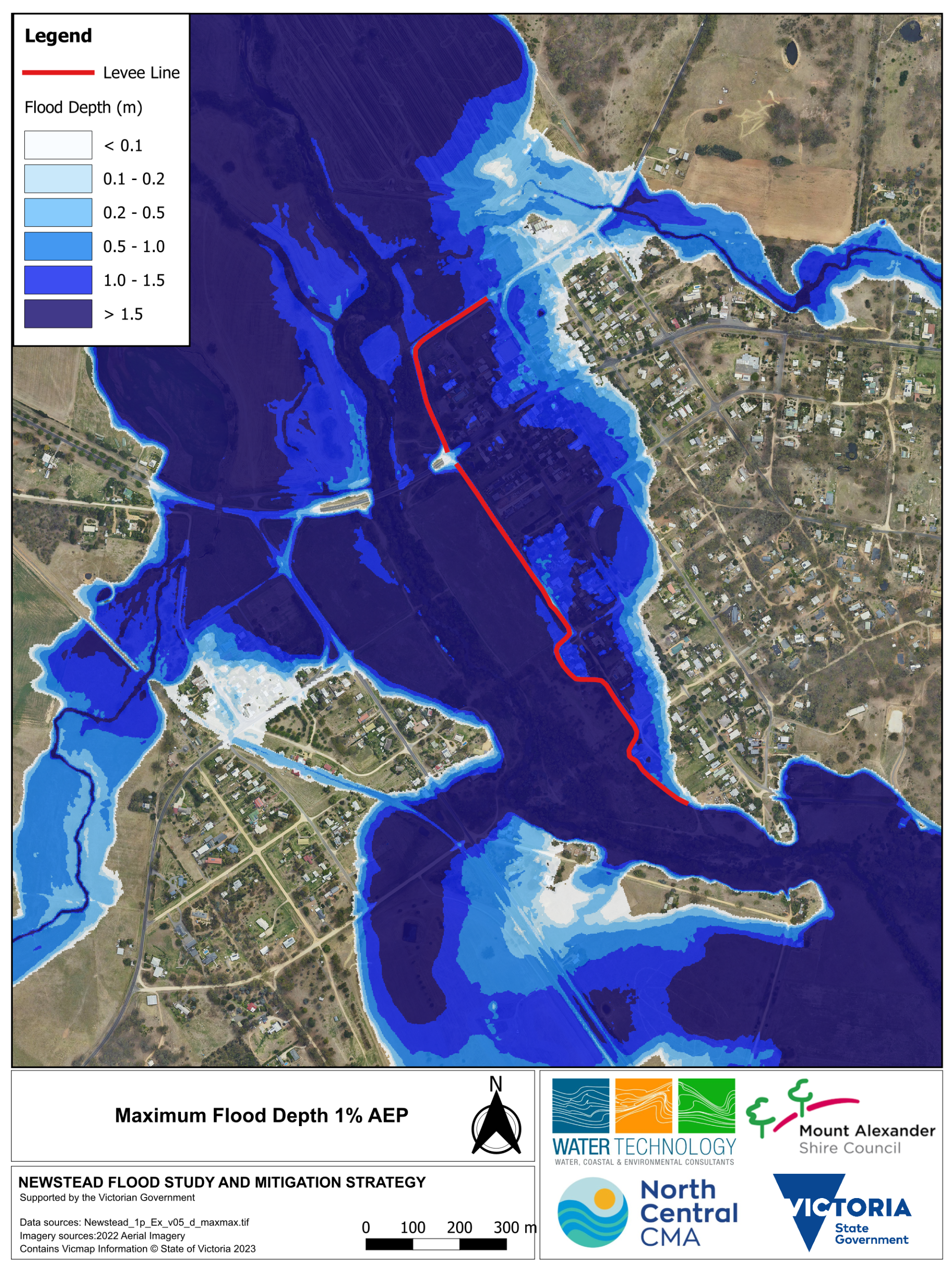
Before vegetation removal (1% AEP maximum flood depth map)
After vegetation removal (1% AEP maximum flood depth map after vegetation removal)
Mitigation option 2: Raising the Newstead levee
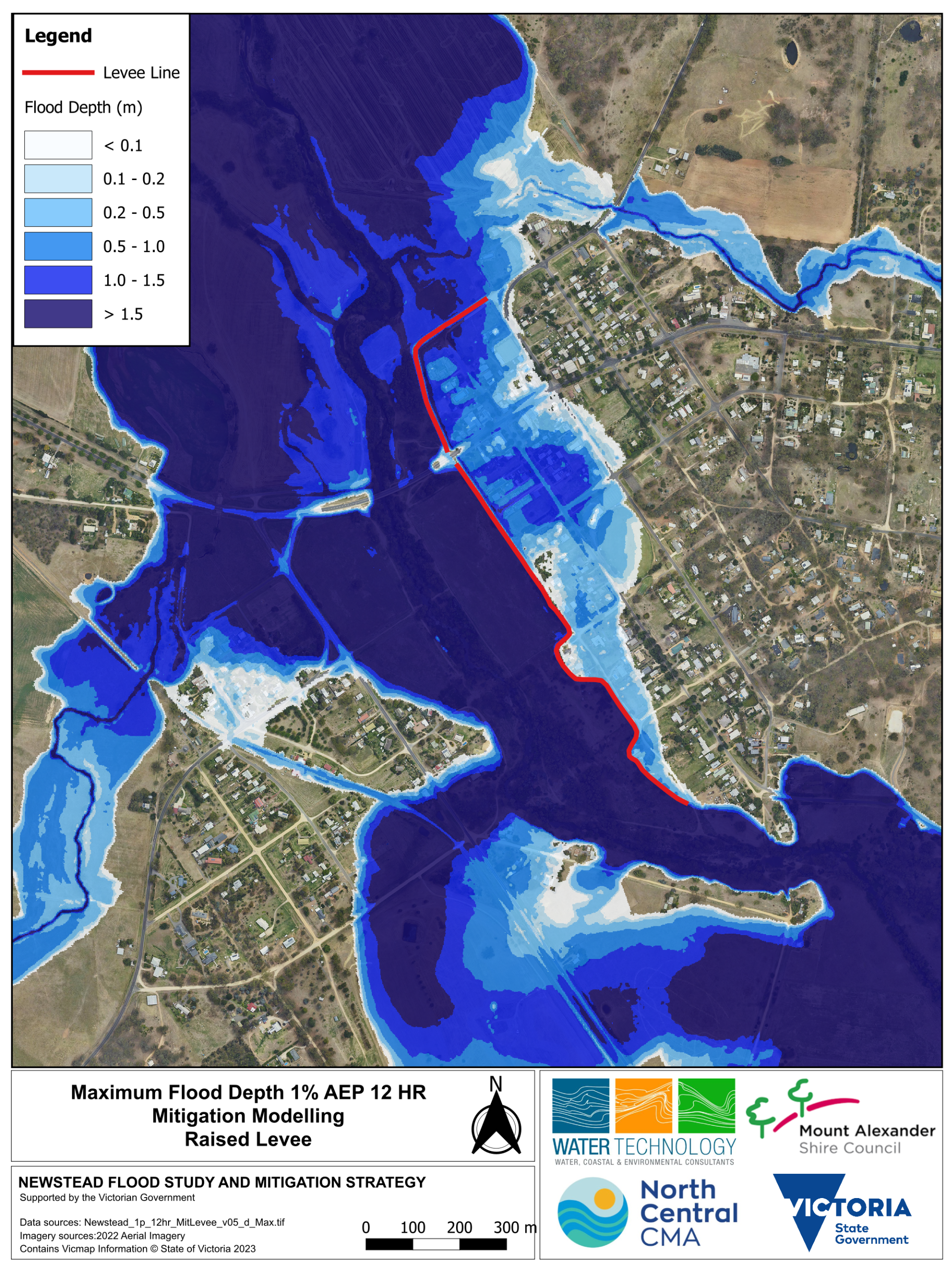
Action: Raising the existing alignment of the levee (without making it longer).
Modelling results indicate that in a 1% AEP event:
- East of the levee: water levels drop by up to 1.4 metres, and reduce the flooded area
- West of the levee: water levels drop by up to 1.4 metres, and reduce the flooded area
- 35 fewer properties East of the levee would experience water above the floor level
- No additional properties West of levee would experience water above the floor level
Click maps to enlarge
Before levee is raised (1% AEP maximum flood depth)
After levee is raised (1% AEP maximum flood depth)
Mitigation option 3: Raising and extending the levee
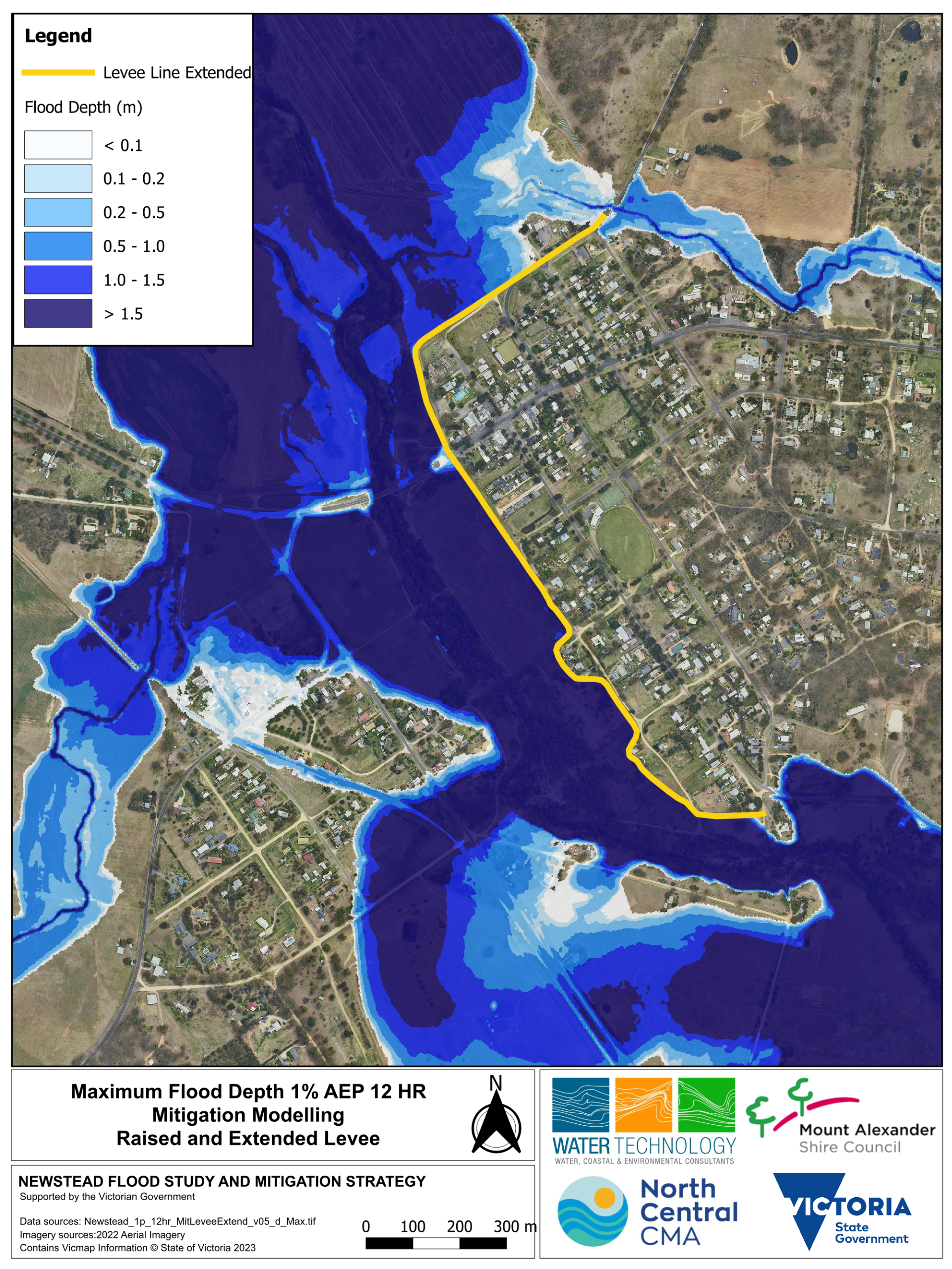
Action: Raising and extending the existing alignment of the levee.
Modelling results indicate that in a 1% AEP event:
- East of levee: water is contained
- West of levee: water levels go up by up to 30cm, in some locations along the Loddon River
- 88 fewer properties East of the levee would experience water above the floor level
- No additional properties West of the levee would experience water above the floor level
Click maps to enlarge
Before levee is raised and extended (1% AEP maximum flood depth map)
After levee is raised and extended (1% AEP maximum flood depth)
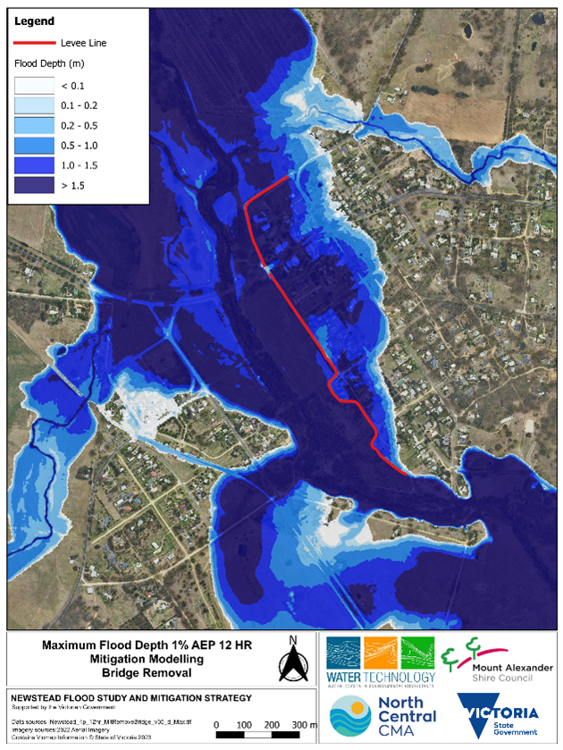
Mitigation option 4: Removing the bridge (Pyrenees Highway Bridge)
Action: Removing the abutment and pillar in waterway.
Modelling results indicate that in a 1% AEP event:
- East of levee: reduces the water level by up to 150 mm
- West of levee: reduces water level up to 400 mm and does not reduce the flood extent
- East of the levee: 2 fewer properties would experience water above the floor level
- West of the levee: 1 less property would experience water above the floor level
- Outcomes similar to vegetation removal option
Click maps to enlarge
Before the abutment and pillar in the waterway are removed (1% AEP maximum flood depth map)
After the bridge abutment and pillar in the waterway are removed (1% AEP maximum flood depth)
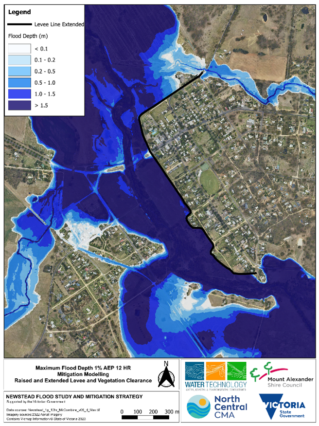
Mitigation option 5: Raising and extending the Newstead levee and vegetation removal
Action: Raising and extending the existing alignment of the levee with vegetation removal.
Modelling results indicate that in a 1% AEP event:
- East of the levee: water is contained.
- West of the levee: water levels go up slightly, in some locations along the Loddon River by up to 25 cm.
- 88 fewer properties East of the levee would experience water above the floor level.
- No additional properties West of levee would experience water above the floor level.
Click maps to enlarge
Before levee is raised and extended (1% AEP maximum flood depth map).
After levee is raised and extended and vegetation is removed (1% AEP maximum flood depth)


