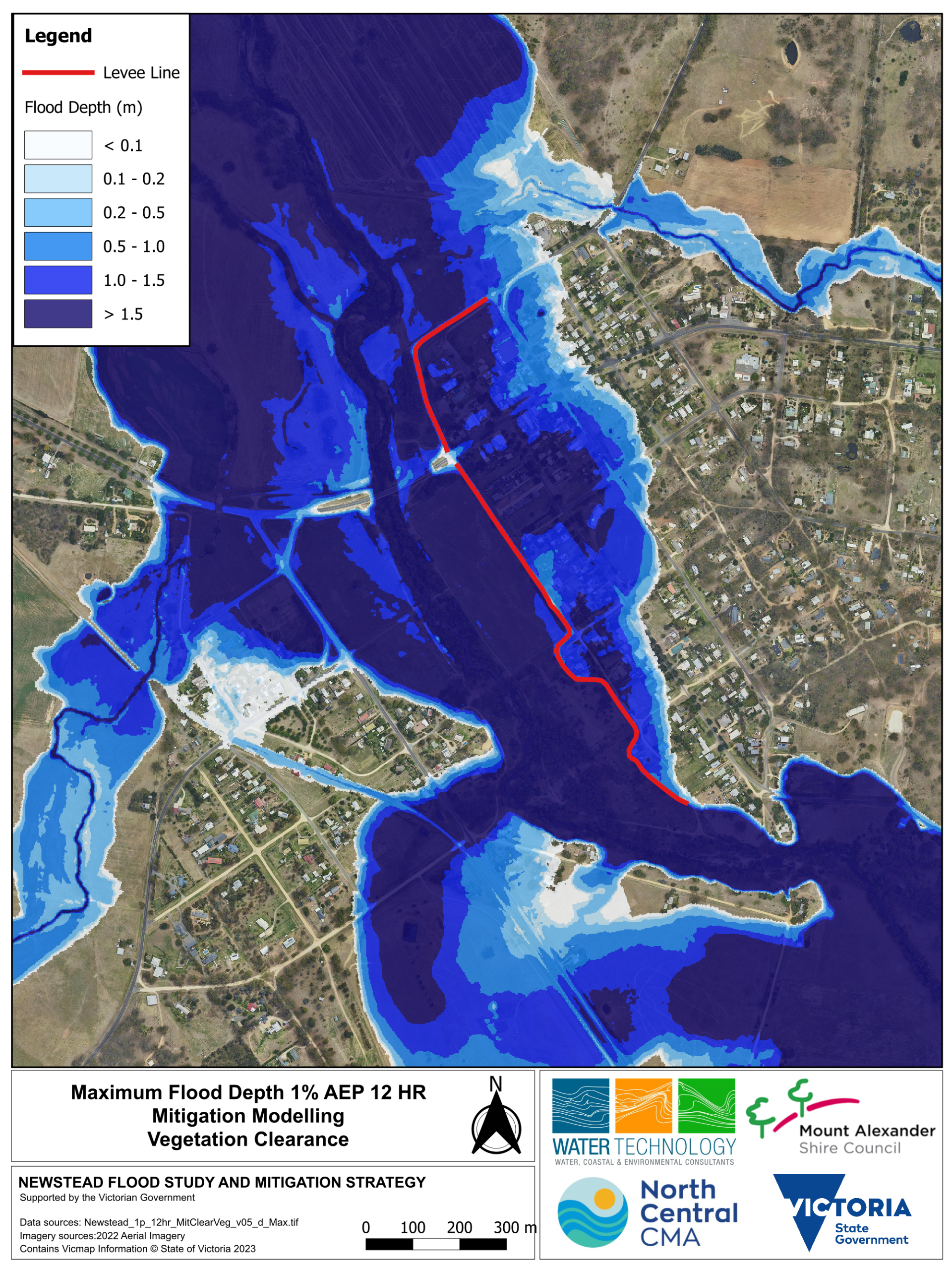
Mitigation option 1: Vegetation removal
Action: Vegetation clearance within and along the Loddon River near and downstream of the Pyrenees Highway bridge.
Modelling results indicate that in a 1% AEP event:
- East of levee: water levels will drop by up to 15 cm
- West of levee: water levels will drop by up to 30 cm
- East of the levee: 2 fewer properties would experience water above the floor level
- West of the levee: 1 less property would experience water above the floor level
Click maps to enlarge

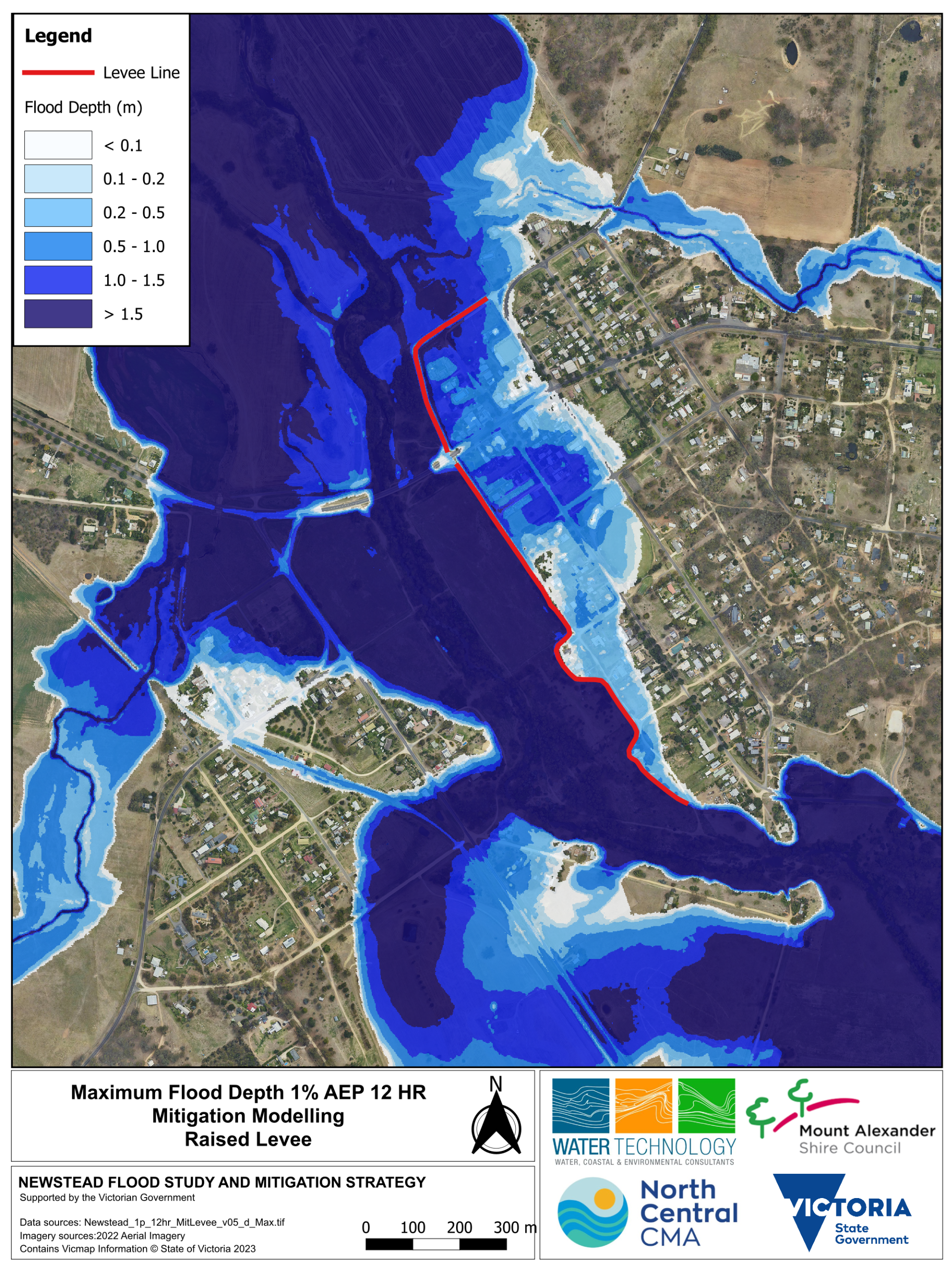
Mitigation option 2: Raising the Newstead levee
Action: Raising the existing alignment of the levee (without making it longer).
Modelling results indicate that in a 1% AEP event:
- East of the levee: water levels drop by up to 1.4 metres, and reduce the flooded area
- West of the levee: water levels drop by up to 1.4 metres, and reduce the flooded area
- 35 fewer properties East of the levee would experience water above the floor level
- No additional properties West of levee would experience water above the floor level
Click maps to enlarge
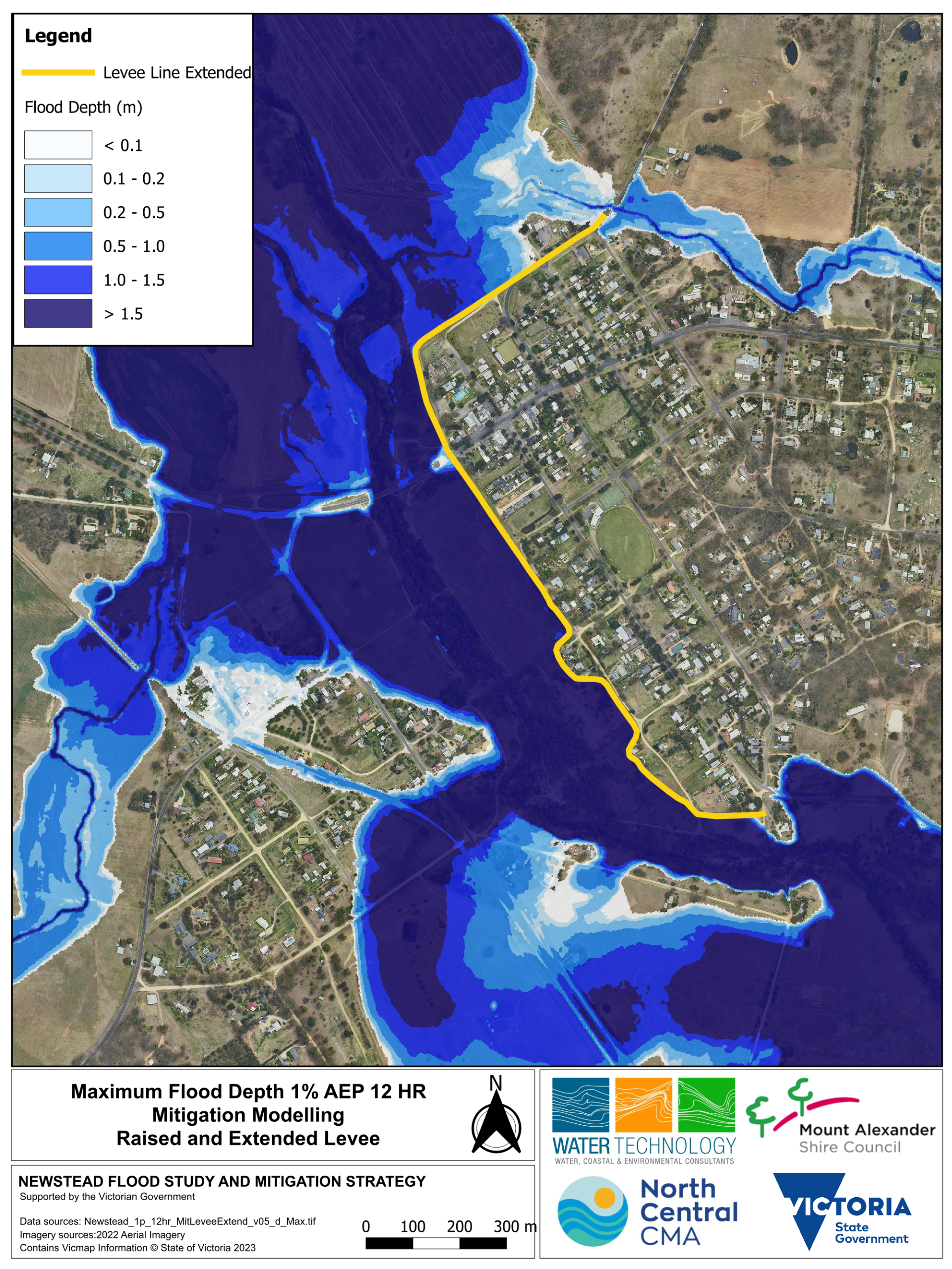
Mitigation option 3: Raising and extending the levee
Action: Raising and extending the existing alignment of the levee.
Modelling results indicate that in a 1% AEP event:
- East of levee: water is contained
- West of levee: water levels go up by up to 30cm, in some locations along the Loddon River
- 88 fewer properties East of the levee would experience water above the floor level
- No additional properties West of the levee would experience water above the floor level
Click maps to enlarge
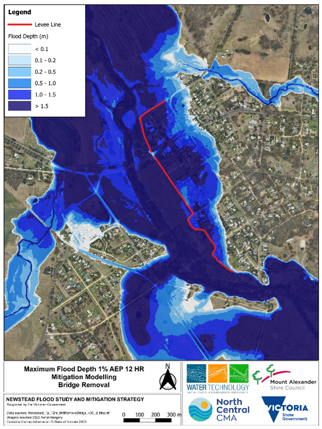
Mitigation option 4: Removing the bridge (Pyrenees Highway Bridge)
Action: Removing the abutment and pillar in waterway.
Modelling results indicate that in a 1% AEP event:
- East of levee: reduces the water level by up to 150 mm
- West of levee: reduces water level up to 400 mm and does not reduce the flood extent
- East of the levee: 2 fewer properties would experience water above the floor level
- West of the levee: 1 less property would experience water above the floor level
- Outcomes similar to vegetation removal option
Click maps to enlarge
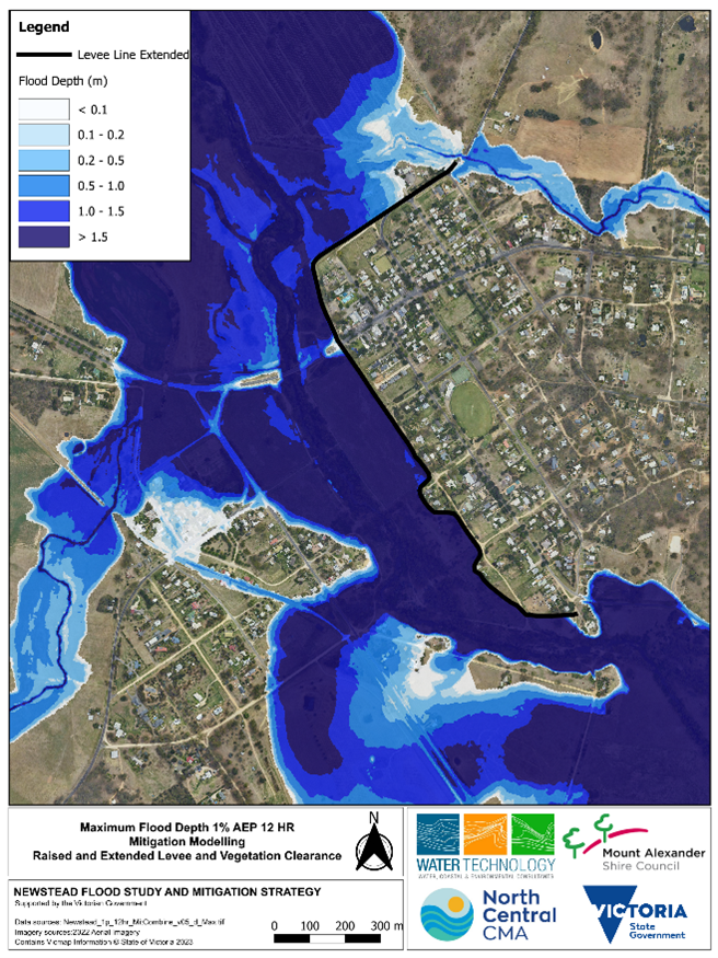
Mitigation option 5: Raising and extending the Newstead levee and vegetation removal
Action: Raising and extending the existing alignment of the levee with vegetation removal.
Modelling results indicate that in a 1% AEP event:
- East of the levee: water is contained.
- West of the levee: water levels go up slightly, in some locations along the Loddon River by up to 25 cm.
- 88 fewer properties East of the levee would experience water above the floor level.
- No additional properties West of levee would experience water above the floor level.
Click maps to enlarge