As part of the Newstead Flood Study Council and stakeholders have developed three mitigation options as outlined below, with the objective of managing future flooding in Newstead. Please read them carefully and provide your feedback at the bottom of the page.
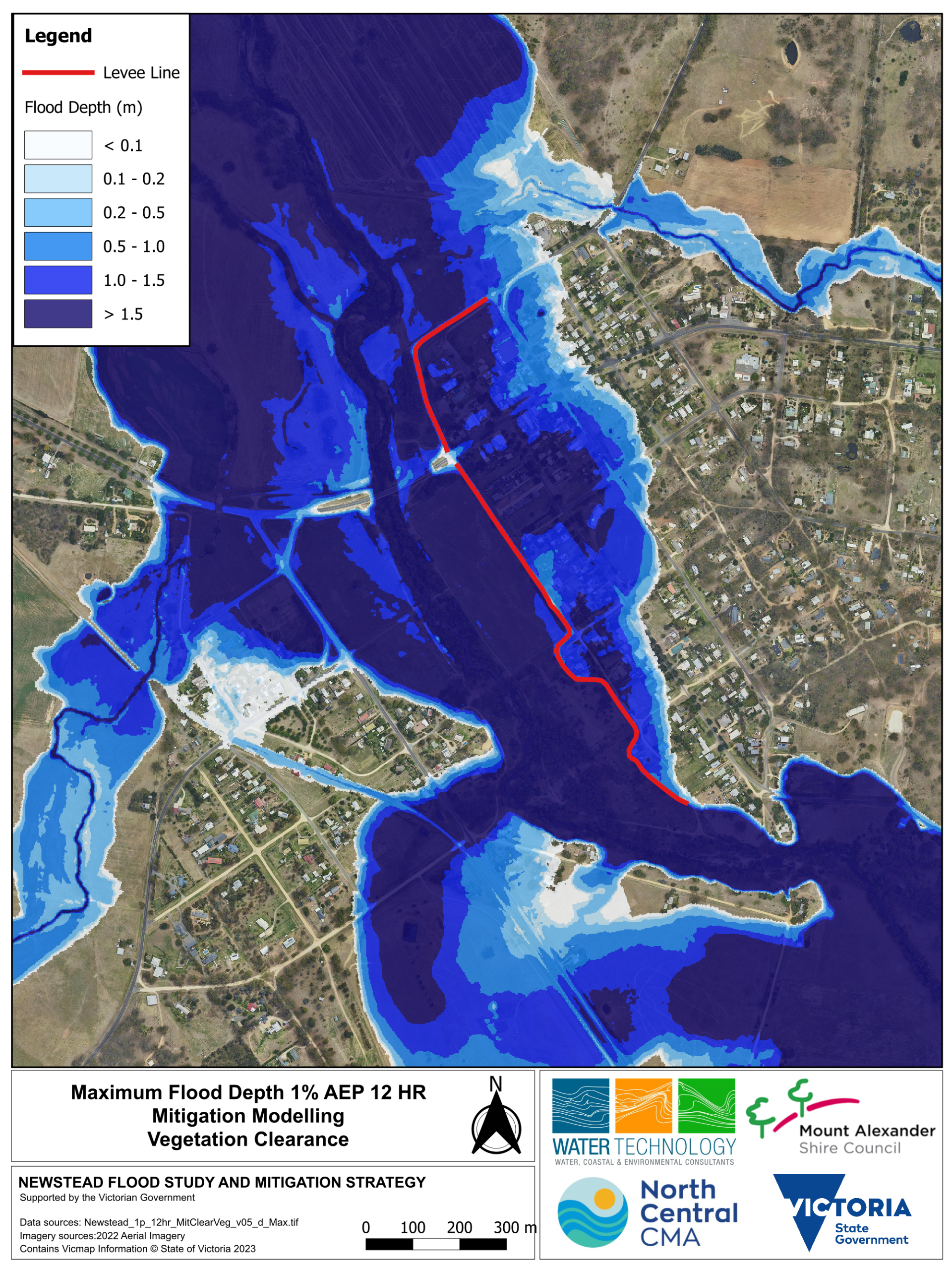
Mitigation option A: Vegetation removal
The below option shows what would happen if vegetation was removed in the Loddon River channel at and downstream of the Pyrenees highway bridge to allow water to drain away form the town more quickly.
Modelling outcome:
- Reduce the flood level by up to 150 mm inside the levee
- Reduces the flood level up to 300 mm outside the levee, but does not reduce the flood extent
- Three less properties flooded above the floor
Click maps to enlarge

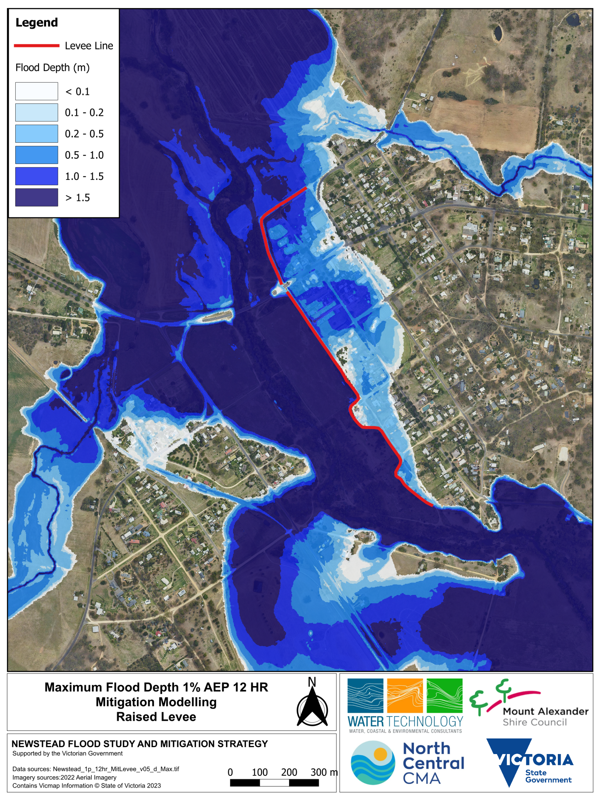
Mitigation option B: Raising the Newstead levee
The below option shows what would happen if the existing levee alignment was raised but not extended.
Modelling outcome:
- Reduces the flood level by up to 1.4 m
- Reduces the flood extent by up to 100 m inside the levee
- Increases flood levels outside the levee by up to 300 mm
- The reduction in flood level will result in 35 less properties flooded above floor
Click maps to enlarge
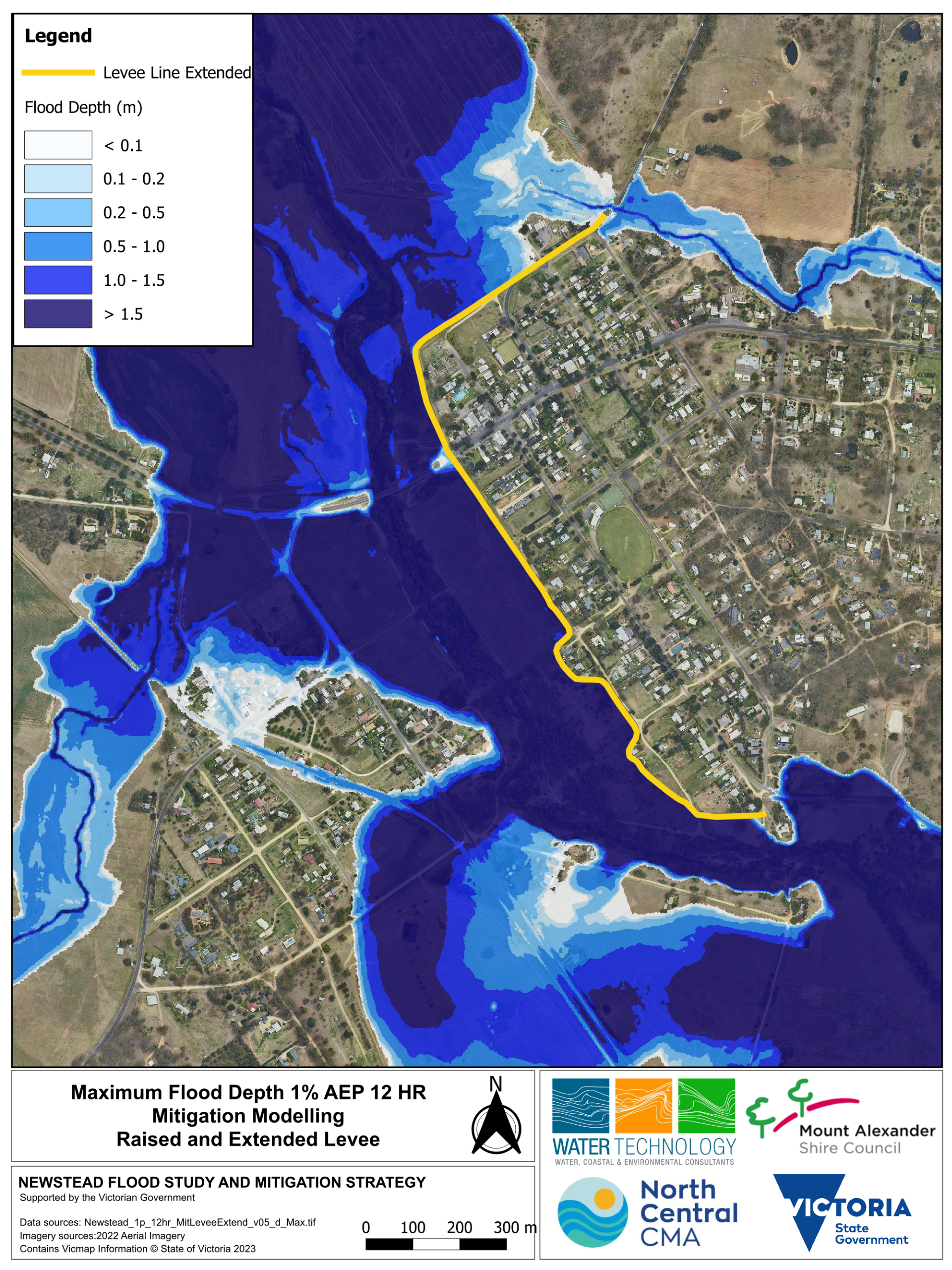
Mitigation option C: Raising and extending the levee
The below option shows what would happen if existing levee is raised and extended. This option removes the flood extent inside the levee, while increasing flood levels outside the levee by up to 300 mm.
Modelling outcome:
- Increase the flood levels outside the levee by up to 300 mm
- The reduction in flood level and extent results in 88 less properties flooded above floor
Click maps to enlarge